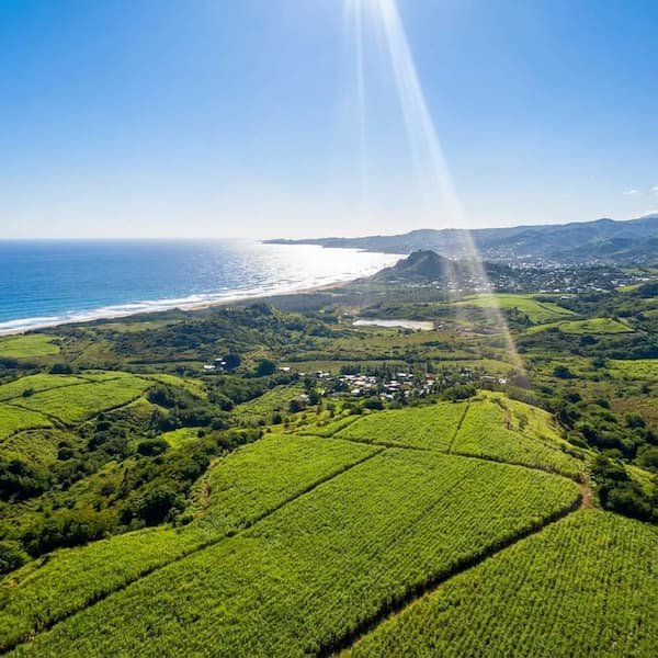
Driving the Barbados East Coast is a dramatic departure from the calm, turquoise luxury of the West Coast. Here, the landscape transforms into a rugged, “Jurassic” environment where the air is thick with salt spray and the Atlantic Ocean pummels the shore with relentless energy. It is a region defined by the Scotland District’s undulating hills and the sheer technicality of the roads, offering a raw, cinematic experience that feels like discovering a hidden side of the Caribbean. The atmosphere is one of slow-paced adventure, where the roar of the surf at Soup Bowl replaces the sound of beach club music, and the journey itself—navigating narrow ridges and steep descents—is as much an attraction as the destination.
The experience is inherently tactical and sensory. You aren’t just a passenger; you are an active navigator dealing with the “Horse Hill” descent and watching for the vertical drops of “Road Subsidence” areas. Between the adrenaline of the narrow village passes, you’ll find moments of profound stillness, whether it’s pulling over on the Ermy Bourne Highway to watch the mist rise off the breakers or stopping at a roadside rum shop where the only rush is the wind through the mahogany trees. It is the ultimate road trip for those who prefer untamed nature and local authenticity over manicured resort life. Understanding the Geology of the Mushroom Rocks provides essential context for the shapes you will see emerging from the foam as you descend toward the coast.
The Horse Hill Descent (Hwy 3)
As you approach Bathsheba via Highway 3, you encounter the legendary Horse Hill, a steep, winding descent that offers one of the first panoramic reveals of the Atlantic coastline. Driving this stretch requires focus; local wisdom dictates shifting into a lower gear (L or 2) to utilise engine braking and prevent your rental car’s brakes from fading on the rapid 800-foot elevation drop. The reward for this technical driving is a bird’s-eye view of the St. Joseph parish, where the lush canopy suddenly gives way to the white-water froth of the distant Atlantic. Ensure you consult our transport guide for specific rental car recommendations suited for these gradients.
Key Viewpoint: Look for safe pull-off points near the top of the ridge for the best long-lens photography of the Soup Bowl. There is a small gravel shoulder approximately 300 yards before the sharpest hairpin turn that offers a clear line of sight over the coconut groves.
Mastering Bajan Backroads
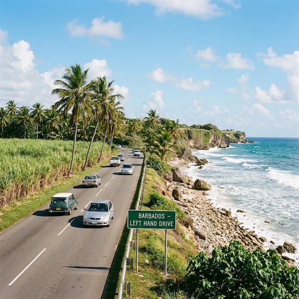
- Left-Hand Logic: Barbados follows the British system. Always stay to the left, particularly when exiting the narrow, unmarked “cart roads” that service the sugar cane fields.
- Roundabout Flow: Traffic already inside the circle has the right of way. Use your indicators early to signal your exit, as local drivers move with decisive speed.
- The Scotland District Soil: This region sits on unstable clay. “Subsidence” signs are literal warnings. You will notice “gabions”—wire cages filled with rocks—used to shore up the cliffside. Maintain a lower speed to protect your vehicle’s suspension from sudden vertical drops in the asphalt.
- Headlight Etiquette: If an oncoming driver flashes their beams at a narrow bridge, they are yielding to you. A quick double-tap of your horn is the standard Bajan “thank you.”
Navigating the East Coast is as much about infrastructure as it is about intuition. While GPS is helpful, it frequently directs drivers onto impassable tracks. To reach Bathsheba safely, prioritise the white-and-black directional signs for “Hwy 3” (the same route used by the Route 6 Bus from Fairchild Street; fare $3.50 BBD) over unverified digital shortcuts. If you find yourself on a road that has narrowed to the width of a single vehicle with tall cane on both sides, you have likely missed a turn-off. For those arriving from the south, the Six Roads Service Stations in St. Philip serve as a critical tactical pitstop. This is the last reliable source of fuel and high-quality local food before the roads become significantly more remote.
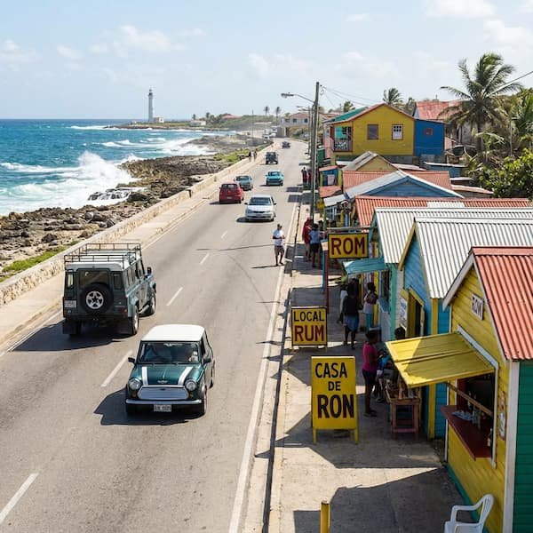
Rum Shops & Roadside Culture
No East Coast road trip is complete without a stop at a local rum shop. These brightly coloured wooden shacks are the social fabric of the eastern parishes. In St. Joseph, these shops serve as unofficial waypoints for navigators. Grab a cold Deputy beer or a snack of “cutters” (salt bread sandwiches) while soaking in the local chatter. If you are looking for something more formal, the Dining and Refreshments guide highlights the historic establishments overlooking the breakers.
Parking Warning: When stopping at the Round House or nearby cafes, you will be parking on a dramatic 15-degree slope. Ensure your handbrake is fully engaged and turn your wheels toward the curb. On the East Coast, gravity is a constant factor in every logistics decision.
“The East Coast isn’t about reaching the destination; it’s about the technical dance between the steering wheel and the scenery.”
Essential Logistics for the Eastern Parishes
| Feature | Detail / Advice | Best Time / Note |
|---|---|---|
| Fuel Availability | Six Roads Junction (St. Philip) is the final gateway station. | Before 10:00 am |
| Road Conditions | Scotland District clay causes frequent asphalt shifts. | Watch for “Subsidence” signs. |
| Photography | Low tide is essential for Mushroom Rock silhouettes. | Check local tide charts. |
| Night Driving | Street lighting is minimal; high-beam use is constant. | Not recommended for visitors. |
Timing your drive is the difference between a scenic cruise and a traffic-clogged trek. During the “North Swell” season from October to March, traffic into Bathsheba increases significantly as spectators flock to see professional surfers tackle the Soup Bowl. Parking near the park becomes competitive; aim to arrive before 9:00 am to secure a spot that doesn’t require a half-mile walk back uphill. If you’re planning a full day, consider combining your drive with a visit to Nearby Attractions like Andromeda Botanic Gardens, which offers one of the few designated, stable parking lots in the parish.
Pro Tips for the Journey
- The Ermy Bourne Highway: Locally known as the “East Coast Road,” this is the island’s only long, straight stretch of asphalt. It runs from Bathsheba north toward Belleplaine and is the premier location for panoramic photography without obstructing parish traffic.
- Maritime Safety: Always remember that the Atlantic side is not for swimming. Review our Atlantic Safety Guide to understand the rip currents that define this coastline.
- Tide-Timed Arrivals: The iconic “stems” of the coral boulders are best viewed at low tide. At high tide, the hydrostatic pressure of the waves often obscures the very geological features that make the St. Joseph coast unique.
- Visibility: Sunset in Barbados occurs rapidly, usually around 5:45 pm to 6:30 pm depending on the season. Because of the lack of reflective road markers and the steep drop-offs, plan to be off the Horse Hill descent before dusk.
For more comprehensive advice on preparing for the elements, visit our Safety and Visitor Logistics page, which covers everything from footwear for the slippery coral to local weather patterns. Whether you are a professional photographer chasing the morning light or a surfer heading for the swell, the drive to the East Coast remains the most authentic road experience in the Caribbean.

6- Hour Coastal Tour of Barbados with Drinks, Snacks and Lunch
⭐ Professional local guide included
🔥 Booked 10 times this week

A Good Bajan Day – Bestselling Barbados Highlights Tour
⭐ Professional local guide included
🔥 Top Selling Experience